Hello!
I have just returned from a week-long trip to Canada! Since I knew I wouldn’t be going to the gym all week, I decided to take a break from blogging while I was away. I figured people probably didn’t want to read about my short 2+mile runs around the neighborhood where I was staying, followed by sitting in a hot tub and doing little-to-no strength training besides a few sit-ups…
Before I get back into regular “fitness-talk”, here are a few pictures from my time away!
 One of my cousins’ playful kitties
 Another cute lil’ kitty! This one is my boyfriend’s parents’ cat.
 And his parents’ dog; playing fetch 🙂
 And a verrry tasty salad made with romaine lettuce, red cabbage, chopped up dried dates, sliced almonds, and grilled chicken. It was pretty good!
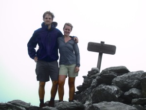
Alright, today I have a hike review for you. My boyfriend went on our first hike of the year yesterday and it was such a nice hike that I thought it was worthy of a review.
Mount Abraham
Location: Lincoln, VT
Parking: Take route 116 north from Bristol or south from Hinesburg and turn onto Lincoln Road, which turns into W River Road. About 2 miles after turning off 116 onto Lincoln Road, there is a fork. Stay left and turn onto Forge Hill Road. Stay on Forge Hill Road until the next fork where you will take the right fork this time by turning onto Quaker Street. Immediately after turning onto Quaker Street, you will see Elder Hill Road on your left. Follow this road all the way to the end until you reach the parking area and the trail head. There are signs for Battell Trail once you turn onto Elder Hill Road so it is pretty easy to find the parking area.
Distance: 2.75 miles from parking lot to summit (5.5 miles round-trip)
Difficulty: 6.5 out of 10
Description: The trail starts out with gradual incline for about the first 0.5 miles with plenty of switchbacks to keep it from getting too steep. There are two small bridges at the 1.0 mile mark, which makes for a nice “One mile to go!” marker on the way back down. I’m sure this will be cleared up soon enough but yesterday, right around 1.8 miles or so, there was a large tree across the trail. We chose to go around it on the way up but found it much easier to just climb through it on the way back down. At around 2 miles, you will come across the Battell shelter where you are able to stay the night if you choose to. It’s just a lean-to so I would recommend bringing a tent to set up so that you don’t get attacked by mosquitoes. Veer left at the shelter to continue up 0.8 miles to the summit! This is where the trail gets steeper and at about 2.4 miles, the trail turns to rocks and gets technical. If you have poles, I would recommend bringing them on this hike because they are very helpful on the way back down the rocks. Especially on a day like yesterday where there had been rain in the morning, the rocks can get slippery and poles make things much more stable.
Time: This took my boyfriend and I just under 3 hours (minus the time we spent eating food at the top)
View: Unfortunately, there was no view when we got to the top due to the thundery/rainy week we’ve had so far…but usually it’s very nice! You can see other mountains in the Green Mountain range and it is quite impressive.
So, if you’re going to be in the Burlington area, I recommend taking a little drive south to Lincoln for a great hike!

